Technology is enabling conservation scientists to collect and analyze data with an efficiency unimagined just decades ago. Satellite and drone-based remote sensing allow rapid mapping and monitoring of environmental conditions; networked sensors such as camera traps and flow meters provide real-time data about the health and potential threats to important resources.
Data are fundamental to making science-based conservation decisions. By modernizing environmental data capture and analysis and streamlining the delivery of usable information to decision makers, we can unlock new opportunities for transformative change in resource management.
The Conservancy’s team of designers, engineers, and data scientists are continually applying new applications of technology to increase the pace and scale of conservation in California – and beyond.
Science in Action
Terrestrial | Planning | Technology
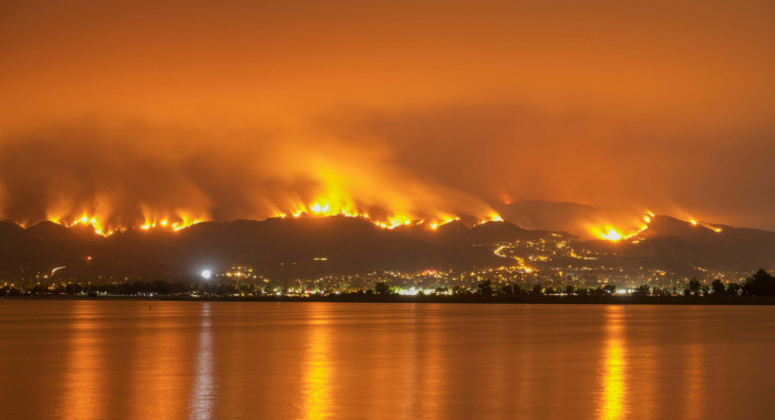
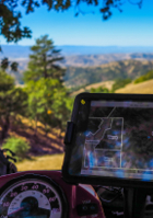
Wildfire and Communities
How can land protection and restoration help protect communities from wildfire?
Marine | Technology | Science
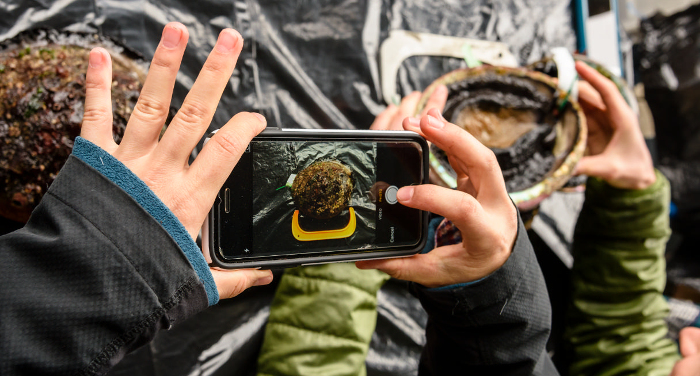
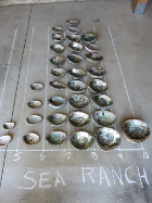
Closing the Abalone Data Gap
Can putting technology in the hands of citizen scientists transform how abalone are managed?
Products
2019 | Marine | Technology | Science | Publications & Reports
eCatch: Enabling collaborative fisheries management with technology
Matt Merrifield, Mary Gleason, Lyall Bellquist, Kate Kauer, Dwayne Oberhoff, Chad Burt, Steve Reinecke, Michael Bella
In 2006, The Nature Conservancy of California purchased 13 federal groundfish permits in California with the objective of managing the fishing and reporting activities in a manner that protected…
2019 | Freshwater | Technology | Science | Maps & Webmaps
GDE Pulse: Monitoring Groundwater Dependent Ecosystems with Satellites
Kirk Klausmeyer, Falk Schuetzenmeister, Nathaniel Rindlaub, Tanushree Biswas, Melissa M. Rohde, Jeanette Howard
94,333 unique ecosystems depend on groundwater in California. GDE Pulse lets you see how they have changed over the last 30 years. Groundwater managers and environmental stakeholders often lack…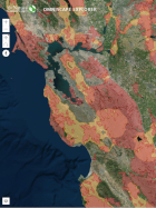
2019 | Terrestrial | Planning | Technology | Science | Maps & Webmaps
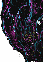
Planning for connectivity implementation in present-day California and for a changing future: a 3-D web-tour
Carrie Schloss, Dick Cameron, Nathaniel Rindlaub, Connor Shank
This interactive, web-based tour provides an accessible introduction to The Nature Conservancy’s analysis of wildlife movement routes for climate adaptation in California. Viewing these pathways…
2019 | Terrestrial | Planning | Technology | Science | Publications & Reports
Circuit-theory applications to connectivity science and conservation
Brett G. Dickson, Christine M. Albano, Ranjan Anantharaman, Paul Beier, Joe Fargione, Tabitha A. Graves, Miranda E. Gray, Kimberly R. Hall, Josh J. Lawler, Paul B. Leonard, Caitlin E. Littlefield, Meredith L. McClure, John Novembre, Carrie A. Schloss, Nathan H. Schumaker, Viral B. Shah, David M. Theobald
The authors explore the impact that Brad McRae’s development of circuit theory and the associated software, Circuitscape, have had, and continue to have, on connectivity science and…
2019 | Marine | Technology | Science | Publications & Reports
Opportunities to improve fisheries management through innovative technology and advanced data systems
Darcy Bradley, Matt Merrifield, Karly M. Miller, Serena Lomonico, Jono R. Wilson, Mary G. Gleason
A lack of fishery data leads to uncertainty about stock status, which may compromise and threaten the economic and food security of the users dependent upon that stock and increase the…
2018 | Terrestrial | Technology | Science | Publications & Reports
A test of desert shrub facilitation via radiotelemetric monitoring of a diurnal lizard
Michael F. Westphal, Taylor Noble, Harry Scott Butterfield, Christopher J. Lortie
Shrubs can play a key role in the structure of desert communities and can function as foundation species. Understanding desert shrub ecology is therefore an important task in desert conservation. In…
2018 | Marine | Planning | Technology | Science | Blogs
Managing Fisheries in the Face of Climate Change
The author discusses a need for a new paradigm in fisheries management to address the challenges of a changing climate. See related publication by the author and colleagues in Conservation…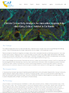
2018 | Terrestrial | Planning | Technology | Science | Blogs
Climate Connectivity Analysis: An Innovation Approach to Identifying Critical Habitat in California
Alex Leumer, Carrie Schloss, Cara Lacey
Plants and animals lack the ability to change their environment. As their current habitat becomes unsuitable due to climate change, they may search out new, more suitable habitat to adapt to changing…
2018 | Marine | Technology | Science | Publications & Reports
Adaptive comanagement to achieve climate‐ready fisheries
Jono R. Wilson, Serena Lomonico, Darcy Bradley, Leila Sievanen, Tom Dempsey, Michael Bell, Skyli McAfee, Christopher Costello, Cody Szuwalski, Huff McGonigal, Sean Fitzgerald, Mary Gleason
Climate change is amplifying threats to ocean ecosystems and marine fisheries worldwide. In order to respond appropriately in the face of these ocean changes, commercial and recreational…
2017 | Terrestrial | Technology | Science | Publications & Reports
Testing a Remote Sensing-Based Interactive System for Monitoring Grazed Conservation Lands
Lawrence D. Ford, H. Scott Butterfield, Pete A. Van Hoorn, Kasey B. Allen, Ethan Inlander, Carrie Schloss, Falk Schuetzenmeister, Miriam Tsalyuk
The Nature Conservancy developed RDMapper, a web-based tool that uses satellite-based productivity estimates, rainfall records, and compliance history to identify easement properties at risk of being…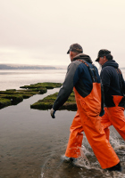
2017 | Marine | Technology | Science | Video
Aquaculture by Design, Tomales Bay
Serena Lomonico, Robert Jones, Torrey Johnson, Sarah Newkirk, Sarah Lummis, Kirk Klausmeyer, John Finger, Terry Sawyer, Richard James
Aquaculture is becoming an increasingly important global food source. With this growth comes urgent, unanswered questions about the interactions of aquaculture operations—both positive and…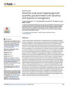
2017 | Terrestrial | Technology | Science | Publications & Reports
Novel fine-scale aerial mapping approach quantifies grassland weed cover dynamics and response to management
Carolyn M. Malmstrom, H. Scott Butterfield, Laura Planck, Christopher W. Long, Valerie T. Eviner
Invasive weeds threaten the biodiversity and forage productivity of grasslands worldwide. However, management of these weeds is constrained by the practical difficulty of detecting small-scale…
2017 | Freshwater | Terrestrial | Marine | Technology | Science | Publications & Reports
Dynamic conservation for migratory species
Mark D. Reynolds, Brian L. Sullivan, Eric Hallstein, Sandra Matsumoto, Steve Kelling, Matthew Merrifield, Daniel Fink, Alison Johnston, Wesley M. Hochachka, Nicholas E. Bruns, Matthew E. Reiter, Sam Veloz, Catherine Hickey, Nathan Elliott, Leslie Martin, John W. Fitzpatrick, Paul Spraycar, Gregory H. Golet, Christopher McColl, Scott A. Morrison
What if instead of buying habitat, conservationists could rent it when and where nature needs it most? The Conservancy is using predictive models of shorebird movements, data from the citizen science…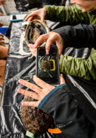
2017 | Marine | Technology | Video
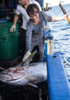
Big Data and the Deep Blue Sea
The Nature Conservancy, Matt Merrifield
Nearly half of the world depends on seafood for their main source of protein. In the Western and Central Pacific, where 60% of the world’s tuna is caught, illegal, unreported, and unregulated…
2016 | Marine | Technology | Science | Video
Sustainable Management of Abalone Fishery in California
The Nature Conservancy, Jono Wilson
California fisheries, like the red abalone fishery, are facing increasing environmental variation and uncertainty due to climate change, complicating the sustainable management of commercial and…
2016 | Terrestrial | Technology | Science | Publications & Reports
Integrating technologies for scalable ecology and conservation
David C. Marvin, Lian Pin Koh, Antony J. Lynam, Serge Wich, Andrew B. Davies, Ramesh Krishnamurthy, Emma Stokes, Ruth Starkey, Gregory P. Asner
Integration of multiple technologies greatly increases the spatial and temporal scales over which ecological patterns and processes can be studied, and threats to protected ecosystems can be…