Technology is enabling conservation scientists to collect and analyze data with an efficiency unimagined just decades ago. Satellite and drone-based remote sensing allow rapid mapping and monitoring of environmental conditions; networked sensors such as camera traps and flow meters provide real-time data about the health and potential threats to important resources.
Data are fundamental to making science-based conservation decisions. By modernizing environmental data capture and analysis and streamlining the delivery of usable information to decision makers, we can unlock new opportunities for transformative change in resource management.
The Conservancy’s team of designers, engineers, and data scientists are continually applying new applications of technology to increase the pace and scale of conservation in California – and beyond.
Science in Action
Terrestrial | Planning | Technology
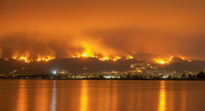
Wildfire and Communities
How can land protection and restoration help protect communities from wildfire?
Marine | Technology | Science
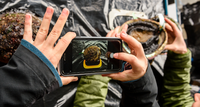
Closing the Abalone Data Gap
Can putting technology in the hands of citizen scientists transform how abalone are managed?
Products

2016 | Terrestrial | Planning | Technology | Science | Publications & Reports
Spatially explicit analysis of field inventories for national forest carbon monitoring
David C. Marvin, Gregory P. Asner
Policies that incentivize forest conservation by monetizing forest carbon ultimately depend on the accuracy of carbon stock estimates. Often, these estimates are based on field inventory sampling. In…
2016 | Freshwater | Terrestrial | Technology | Science | Publications & Reports
Pop-up wetland habitats benefit migrating birds and farmers
Christopher J. McColl, Katie Andrews, Mark Reynolds, Gregory H. Golet
In response to the decline of wetland habitats for migrating and wintering water birds in California, the Conservancy developed a program called BirdReturns that creates “pop-up”…
2015 | Freshwater | Terrestrial | Technology | Publications & Reports
Abundance models improve spatial and temporal prioritization of conservation resources
Johnston, A., D. Fink, M. D. Reynolds, W. M. Hochachka, B. L. Sullivan, N. E. Bruns, E. Hallstein, M. S. Merrifield, S. Matsumoto, S. Kelling
Global declines in migratory species in response to accelerating habitat destruction and climate change challenge the scope and scale of conservation efforts. The ability to pinpoint where and when…
2014 | Terrestrial | Technology | Science | Publications & Reports
A multi-scale distribution model for non-equilibrium populations suggests resource limitation in an endangered rodent
Tim Bean, Bob Stafford, Scott Butterfield, Justin Brashares
This paper presents a multi-step approach to estimate the realized and potential distribution of the endangered giant kangaroo rat. The authors estimate the potential distribution by modeling…
2014 | Freshwater | Terrestrial | Technology | Science | Blogs
A Renter’s Market: BirdReturns Offers Innovative Conservation
Eric Hallstein, Matt Miller
2014 | Terrestrial | Technology | Publications & Reports
Remote Sensing and Residual Dry Matter Monitoring
H. Scott Butterfield, Miriam Tsalyuk, Carrie Schloss
The Nature Conservancy in California monitors residual dry matter (RDM) on approximately 300,000 acres of conservation lands. Researchers evaluated whether satellite remote sensing data could be used…
2014 | Terrestrial | Technology | Science | Publications & Reports
Species distribution models of an endangered rodent offer conflicting measures of habitat quality at multiple scales
Tim Bean, Laura Prugh, Bob Stafford, Scott Butterfield, Mike Westphal, Justin Brashares
In this study, the authors developed a suite of species distribution models (SDMs) for the endangered giant kangaroo rat using the machine-learning method Maxent. They compared these models with three…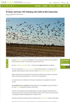
2014 | | Technology | Publications & Reports
eBird enterprise: integrated approach to development and application of citizen science
Brian L. Sullivan, Jocelyn L. Aycrigg, Jessie H. Barry , Rick E. Bonney, Nicholas Bruns, Caren B. Cooper, Theo Damoulas, André A. Dhondt , Tom Dietterich, Andrew Farnsworth, Daniel Fink, John W. Fitzpatrick, Thomas Fredericks, Jeff Gerbracht, Carla Gomes, Wesley M. Hochachka, Marshall J. Iliff, Carl Lagoze, Frank A. La Sorte, Matthew Merrifield, Will Morris, Tina B. Phillips, Mark Reynolds, Amanda D. Rodewald, Kenneth V. Rosenberg, Nancy M. Trautmann, Andrea Wiggins, David W. Winkler, Weng-Keen Wong, Christopher L. Wood, Jun Yu, Steve Kelling
This paper outlines how eBird has evolved from a basic citizen-science project into a collective enterprise, taking a novel approach to citizen science by developing cooperative partnerships…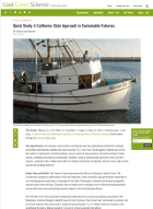
2013 | Marine | Technology | Science | Blogs
Quick Study: A California-Style Approach to Sustainable Fisheries
Darci Palmquist, Mary Gleason, Matt Merrifield
2013 | Marine | Planning | Technology | Publications & Reports
MarineMap: A web-based platform for collaborative marine protected area planning
Matthew S. Merrifield, Will McClintock, Chad Burt, Evan Fox, Paulo Serpa, Charles Steinback, Mary Gleason
This paper reviews the creation and use of MarineMap, a spatial decision support system that enabled stakeholder participation in designing marine protected areas (MPAs). The authors highlight why it…
2012 | Terrestrial | Technology | Science | Publications & Reports
An evaluation of monitoring methods for the endangered giant kangaroo rat
Tim Bean, Bob Stafford, Laura Prugh, Scott Butterfield, Justin Brashares
This paper compares the efficacy of different monitoring methods for estimating distribution, abundance, and population growth of the endangered giant kangaroo rat to determine the best practices for…
2011 | Terrestrial | Technology | Publications & Reports
The use of airborne laser scanning to develop a pixel-based stratification for a verified carbon offset project
Jordan Golinkoff, Mark Hanus, Jennifer Carah
The voluntary carbon market is a new and growing market that is increasingly important to consider in managing forestland. Monitoring, reporting, and verifying carbon stocks and fluxes at a project…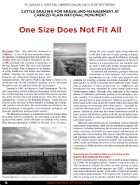
2008 | Terrestrial | Technology | Science | Publications & Reports
One size does not fit all: the use of cattle grazing for grassland management at Carrizo Plain National Monument
Caroline Christian , Lawrence Saslaw, H. Scott Butterfield
To better understand the ecological role of cattle grazing in managing Carrizo Plain National Monument, we initiated a long-term study in 1997 designed to evaluate the effects of cattle grazing on…