Matt Merrifield

Chief Technology Officer
Technology
[email protected]
As Chief Technology Officer in The Nature Conservancy’s California Chapter, Matt is responsible for research, strategy, and application of technology solutions to serve the Conservancy’s mission. He has 20 years of experience in the field of geospatial technology that encompasses geographic information science, remote sensing, GPS, and drones. He currently leads a team responsible for spatial planning, analysis and technology focused solutions that can have big impacts in social-ecological systems.
Before joining the Conservancy, Matt was the Director of Geographic Information Systems at Space Imaging Corporation where he worked on a variety natural resource mapping projects and developed spatial models to determine fire risk for the Insurance Services Office. He has a B.A. in Geography from University of California, Berkeley and an M.A. in Geographic Information Science and Environmental Planning from San Francisco State University.
What Matt is working on now:
I'm currently working on ways that AI can be utilized in various aspects of the Conservancy's work with a deep focus on fisheries this year. And I'll be going back to my geospatial roots and supporting a global scale mapping effort of MPAs that will leverage the Conservancy's deep network of GIS practitioners in field.
Select products
2020 | Freshwater | Terrestrial | Marine | Planning | Technology | Science | Publications & Reports
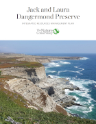
Jack and Laura Dangermond Preserve Integrated Resources Management Plan
Butterfield, H.S., M. Reynolds , M.G. Gleason, M. Merrifield, B.S. Cohen, W.N. Heady, D. Cameron, T. Rick, E. Inlander, M. Katkowski, L. Riege, J. Knapp, S. Gennet, G. Gorga, K. Lin, K. Easterday, B. Leahy, M. Bell
This Plan frames the biological and cultural significance and provides the short- and long-term goals, objectives, and priority actions for the Jack and Laura Dangermond Preserve.2020 | Freshwater | Terrestrial | Marine | Technology | Publications & Reports
Technology Catalyst Fund - 2019 Annual Report
Conservation needs to harness technology to meet the complex challenges of today’s world. The Technology Catalyst Fund provides early stage resources to investigate and prototype technologies…2019 | Marine | Technology | Science | Publications & Reports
eCatch: Enabling collaborative fisheries management with technology
Matt Merrifield, Mary Gleason, Lyall Bellquist, Kate Kauer, Dwayne Oberhoff, Chad Burt, Steve Reinecke, Michael Bella
In 2006, The Nature Conservancy of California purchased 13 federal groundfish permits in California with the objective of managing the fishing and reporting activities in a manner that protected…2019 | Marine | Technology | Science | Publications & Reports
Opportunities to improve fisheries management through innovative technology and advanced data systems
Darcy Bradley, Matt Merrifield, Karly M. Miller, Serena Lomonico, Jono R. Wilson, Mary G. Gleason
A lack of fishery data leads to uncertainty about stock status, which may compromise and threaten the economic and food security of the users dependent upon that stock and increase the…2017 | Freshwater | Terrestrial | Marine | Technology | Science | Publications & Reports
Dynamic conservation for migratory species
Mark D. Reynolds, Brian L. Sullivan, Eric Hallstein, Sandra Matsumoto, Steve Kelling, Matthew Merrifield, Daniel Fink, Alison Johnston, Wesley M. Hochachka, Nicholas E. Bruns, Matthew E. Reiter, Sam Veloz, Catherine Hickey, Nathan Elliott, Leslie Martin, John W. Fitzpatrick, Paul Spraycar, Gregory H. Golet, Christopher McColl, Scott A. Morrison
What if instead of buying habitat, conservationists could rent it when and where nature needs it most? The Conservancy is using predictive models of shorebird movements, data from the citizen science…2017 | Marine | Technology | Video
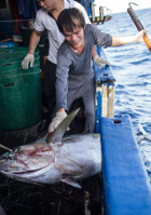
Big Data and the Deep Blue Sea
The Nature Conservancy, Matt Merrifield
Nearly half of the world depends on seafood for their main source of protein. In the Western and Central Pacific, where 60% of the world’s tuna is caught, illegal, unreported, and unregulated…2015 | Freshwater | Terrestrial | Technology | Publications & Reports
Abundance models improve spatial and temporal prioritization of conservation resources
Johnston, A., D. Fink, M. D. Reynolds, W. M. Hochachka, B. L. Sullivan, N. E. Bruns, E. Hallstein, M. S. Merrifield, S. Matsumoto, S. Kelling
Global declines in migratory species in response to accelerating habitat destruction and climate change challenge the scope and scale of conservation efforts. The ability to pinpoint where and when…2015 | Freshwater | Marine | Publications & Reports
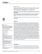
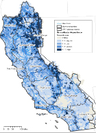
Aligning Natural Resource Conservation and Flood Hazard Mitigation in California
Juliano Calil, Michael W. Beck, Mary Gleason, Matthew Merrifield, Kirk Klausmeyer, Sarah Newkirk
The U.S. National Flood Insurance Program has paid out more than $38 billion in claims since its inception in 1968, more than a third of which has gone to the 1% of policies that experienced multiple,…2015 | Freshwater | Data
Groundwater Dependent Ecosystems in California data
The California Freshwater Species Database is the first comprehensive geospatial database of California’s freshwater species compiled and standardized into single format from nearly 500 sources.…2014 | | Technology | Publications & Reports
eBird enterprise: integrated approach to development and application of citizen science
Brian L. Sullivan, Jocelyn L. Aycrigg, Jessie H. Barry , Rick E. Bonney, Nicholas Bruns, Caren B. Cooper, Theo Damoulas, André A. Dhondt , Tom Dietterich, Andrew Farnsworth, Daniel Fink, John W. Fitzpatrick, Thomas Fredericks, Jeff Gerbracht, Carla Gomes, Wesley M. Hochachka, Marshall J. Iliff, Carl Lagoze, Frank A. La Sorte, Matthew Merrifield, Will Morris, Tina B. Phillips, Mark Reynolds, Amanda D. Rodewald, Kenneth V. Rosenberg, Nancy M. Trautmann, Andrea Wiggins, David W. Winkler, Weng-Keen Wong, Christopher L. Wood, Jun Yu, Steve Kelling
This paper outlines how eBird has evolved from a basic citizen-science project into a collective enterprise, taking a novel approach to citizen science by developing cooperative partnerships…2013 | Marine | Publications & Reports
A Transactional and Collaborative Approach to Reducing Effects of Bottom Trawling
Gleason M, Feller EM, Merrifield M, Copps S, Fujita R, Bell M, Rienecke S, Cook C
On the Central Coast of California, The Nature Conservancy, Environmental Defense Fund, local fishers and local, state, and federal authorities worked collaboratively to protect large areas of the…2013 | Marine | Technology | Science | Blogs
Quick Study: A California-Style Approach to Sustainable Fisheries
Darci Palmquist, Mary Gleason, Matt Merrifield
2013 | Marine | Planning | Technology | Publications & Reports
MarineMap: A web-based platform for collaborative marine protected area planning
Matthew S. Merrifield, Will McClintock, Chad Burt, Evan Fox, Paulo Serpa, Charles Steinback, Mary Gleason
This paper reviews the creation and use of MarineMap, a spatial decision support system that enabled stakeholder participation in designing marine protected areas (MPAs). The authors highlight why it…2012 | Marine | Planning | Science | Maps & Webmaps
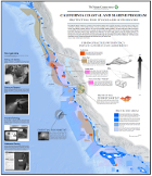
California Coastal and Marine Program: Protecting Fish Stocks and Livelihoods
Since 2007, The Nature Conservancy has pioneered a first-of-its-kind fishery reform approach that aligns communities, the fishing industry, and conservation interests to drive strategic changes in…2011 | Freshwater | Marine | Planning | Publications & Reports
Conservation Assessment of U.S. West Coast Estuaries
Mary Gleason, Sarah Newkirk, Matt Merrifield, Jeanette Howard, Robin Cox, Megan Webb, Jennifer Koepcke, Brian Stranko, Bethany Taylor, Mike Beck, Roger Fuller, Dick VanderSchaaf, Jena Carter
While significant progress has been made over the past few decades in improving estuarine water quality, restoring wetland habitats, and incorporating estuarine habitats into managed areas, estuarine…2010 | Freshwater | Publications & Reports
Mapping Groundwater Dependent Ecosystems in California
In 2014 the California legislature passed a three-bill package (SB 1168, AB 1739, and SB 1319) of groundwater reform legislation that was the most significant update of California water policy in…2010 | Marine | Planning | Publications & Reports
Science-based and stakeholder-driven marine protected area network planning: A successful case study from north central California
Mary Gleason, Scott McCreary, Melissa Miller-Henson, John Ugoretz, Evan Fox, Matt Merrifield, Will McClintock, Paulo Serpa, Kathryn Hoffman
This paper describes the planning process for California's Marine Life Protection Act (MLPA) in north central California. The process represents a case study in the design of a regional component…2006 | Marine | Planning | Publications & Reports
Assessing gaps in marine conservation in California
Mary G. Gleason, Matt S. Merrifield, Chuck Cook, Audrey L. Davenport, Rebecca Shaw
This study is the first marine gap analysis for California. It quantifies what is protected and what is not and highlights conservation needs and opportunities. Less than 5% of marine habitats are…2006 | Marine | Planning | Publications & Reports
Northern California Marine Ecoregional Assessment
Mary Gleason, Matt Merrifield, Chuck Cook, Miguel Hall
The Conservancy's science and planning staff in California prepared this assessment of the most important areas for conservation of marine biodiversity in the Northern California…2004 | Marine | Planning | Publications & Reports
Southern California Marine Ecoregional Assessment
Mary Gleason, Matt Merrifield, Craig Mayer, Michelle McCutchan, Chuck Cook
The Conservancy's science and planning staff in California prepared this assessment of the most important areas for conservation of marine biodiversity in the Southern California Marine…