Katie Andrews
Systems Architect
Technology
[email protected]
In The Nature Conservancy’s California Chapter, Katie applies geospatial technologies to address dynamic water management and other conservation issues. Additionally she manages the development of mobile and web-based tools to improve information access for decision makers. She has nearly 20 years of experience in geographic information systems, spatial analyses, remote sensing and GPS technology.
Before joining the Conservancy, Katie worked for the Bureau of Land Management. She has a B.A. in Environmental Studies from the University of Kansas and an M.S. in Geography from the University of Utah.
What Katie is working on now:
I’m currently working with partners on a project that pairs machine learning and remote sensing to characterize the shallow wet conditions that define great shorebird habitat. As The Nature Conservancy continues to employ dynamic strategies to ensure migrating birds have access to foraging habitat where and when they need it, the ability to monitor their habitat conditions in near real-time using remotely sensed imagery is key to our success and to scaling this work.
Select products
2020 | Terrestrial | Technology | Publications & Reports
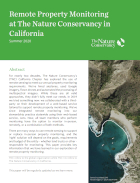
Remote Property Monitoring at The Nature Conservancy in California
Ethan Inlander, Katie Andrews, Contributors: Jennifer Chin, Sue Pollock, Mike McFadden, Scott Hardage, Scott Butterfield, Tod Rubin
With this publication, TNC in California marks a major shift in its approach to conservation easement monitoring. At the crossroads of conservation, stewardship and technology lies remote property…
2018 | Freshwater | Terrestrial | Science | Publications & Reports
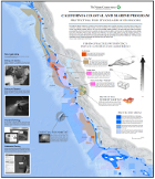
Using ricelands to provide temporary shorebird habitat during migration
Gregory H. Golet, Candace Low, Simon Avery, Katie Andrews, Christopher J. McColl, Rheyna Laney, Mark D. Reynolds
Migratory birds face great challenges due to the climate change, conversion of historical stopover sites, and other factors. To help address these challenges, the Conservancy launched a dynamic…
2016 | Freshwater | Terrestrial | Technology | Science | Publications & Reports
Pop-up wetland habitats benefit migrating birds and farmers
Christopher J. McColl, Katie Andrews, Mark Reynolds, Gregory H. Golet
In response to the decline of wetland habitats for migrating and wintering water birds in California, the Conservancy developed a program called BirdReturns that creates “pop-up”…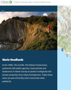
2015 | Terrestrial | Maps & Webmaps
Conservation Legacy in Marin County, California
Katie Andrews, Megan Webb, Robin Cox
This interactive webmap takes a multimedia approach to showcase the Conservancy’s conservation legacy in Marin County, California. Eleven achievements are profiled with photographs and…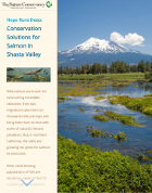
2014 | Freshwater | Maps & Webmaps
Hope Runs Deep: Conservation Solutions for Salmon in Shasta Valley
Using maps, images, and video, this interactive StoryMap illustrates how The Nature Conservancy works with partners in Shasta Valley, California to find conservation solutions that work for…
2013 | Terrestrial | Science | Publications & Reports
Farm practices for food safety: an emerging threat to floodplain and riparian ecosystem
Gennet, S., J. Howard, J. Langholz, K. Andrews, M.D. Reynolds, S.A. Morrison
This paper discusses the 2006 outbreak of toxic foodborne E. coli and its impact on wildlife. The authors explain how farming practices for food safety that target wildlife can damage ecosystems but…