Technology is enabling conservation scientists to collect and analyze data with an efficiency unimagined just decades ago. Satellite and drone-based remote sensing allow rapid mapping and monitoring of environmental conditions; networked sensors such as camera traps and flow meters provide real-time data about the health and potential threats to important resources.
Data are fundamental to making science-based conservation decisions. By modernizing environmental data capture and analysis and streamlining the delivery of usable information to decision makers, we can unlock new opportunities for transformative change in resource management.
The Conservancy’s team of designers, engineers, and data scientists are continually applying new applications of technology to increase the pace and scale of conservation in California – and beyond.
Science in Action
Terrestrial | Planning | Technology
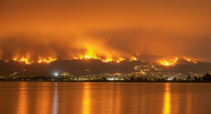
Wildfire and Communities
How can land protection and restoration help protect communities from wildfire?
Marine | Technology | Science
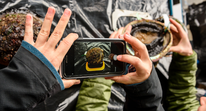
Closing the Abalone Data Gap
Can putting technology in the hands of citizen scientists transform how abalone are managed?
Products
2022 | Terrestrial | Technology | Science | Publications & Reports
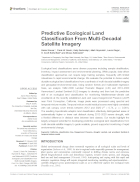
Predictive ecological land classification from multi-decadal satellite imagery
Daniel Sousa, Frank W. Davis, Kelly Easterday, Mark Reynolds, Laura Riege, H. Scott Butterfield, Moses Katkowski
This paper details a first of its kind approach to land classification, using random forests and multivariate regression trees and historical Landsat satellite imagery to map and then assess changes…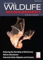
2022 | Freshwater | Terrestrial | Technology | Science | Publications & Reports
Developing an adaptive management approach to cowbird control on the Santa Clara River, California
Sophie S. Parker, Linnea S. Hall, Mary J. Whitfield, Laura Riege, Kathryn R. Selm, René Corado
This paper presents results from a field-based study that can be used to benefit songbirds in riverside habitats like those found along the Santa Clara River in Ventura County, California. Songbirds…
2022 | Freshwater | Terrestrial | Marine | Planning | Technology | Science | Publications & Reports
Prioritizing actions: spatial action maps for conservation
Heather Tallis, Joe Fargione, Edward Game, Rob McDonald, Leandro Baumgarten, Nirmal Bhagabati, Rane Cortez, Bronson Griscom, Jonathan Higgins, Christina M. Kennedy, Joe Kiesecker, Timm Kroeger, Trina Leberer, Jennifer McGowan, Lisa Mandle, Yuta J. Masuda, Scott Morrison, Sally Palmer, Rebecca Shirer, Priya Shyamsundar, Nicholas H.Wolff, and Hugh P. Possingham
Spatial analysis is a powerful tool in conservation planning. Yet it is often under-deployed as a means of elucidating which conservation actions may deliver the highest return on investment. This…
2022 | Terrestrial | Planning | Technology | Science | Publications & Reports
A framework to select strategies for conserving and restoring habitat connectivity in complex landscapes
D. Richard Cameron, Carrie A. Schloss, David M. Theobald, Scott A. Morrison
Protecting or restoring habitat connectivity in landscapes undergoing rapid environmental change requires multiple conservation and restoration strategies. These strategies have different risk…
2022 | Terrestrial | Planning | Technology | Science | Publications & Reports
The influence of model frameworks in spatial planning of regional climate-adaptive connectivity for conservation planning
Hyeyeong Choe, Annika T.H. Keeley, D. Richard Cameron, Melanie Gogol-Prokurat, Lee Hannah, Patrick R. Roehrdanz, Carrie A. Schloss, James H. Thorne
Planning for connectivity conservation often relies on modeled movement routes. However, these pathways can be sensitive to the conservation objective, modeling approach, analysis tool, and…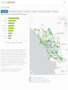
2022 | Freshwater | Terrestrial | Marine | Planning | Technology | Science | Maps & Webmaps
The Mitigation Wizard
Carrie Schloss, Liz O’Donoghue, Dan Rademacher, Patric Huber, Jodi McGraw, Kim Becerril, Janine Knapp
Every year, infrastructure agencies and developers spend hundreds of millions of dollars to mitigate for impacts to sensitive species and habitats. These mitigation sites are often piecemeal projects,…
2022 | Terrestrial | Planning | Technology | Science | Publications & Reports
“No-regrets” pathways for navigating climate change: planning for connectivity with land use, topography, and climate
Carrie A. Schloss, D. Richard Cameron, Brad H. McRae, David M. Theobald, and Aaron Jones
Plant and animal species are already shifting their ranges in response to a changing climate. Maintaining connectivity between present habitat and suitable habitat in the future will become…
2022 | Freshwater | Terrestrial | Technology | Science | Publications & Reports
Quantity and fate of synthetic microfiber emissions from apparel washing in California and strategies for their reduction
Roland Geyer, Jenna Gavigan, Alexis M. Jackson, Vienna R. Saccomanno, Sangwon Suh, Mary G. Gleason
Synthetic microfibers are the most prevalent type of microplastic and apparel washing is a major source of microfiber pollution. Using California as a case study to estimate the magnitude of…
2022 | Marine | Technology | Science | Publications & Reports
Reducing the Risk of Mortality to Whales
Jessica Morten, Ryan Freedman, Jeffrey D. Adams, Jono Wilson, Aliya Rubinstein, Sean Hastings
The great whales, including, blue, humpback, and fin whales are threatened by collisions with ocean going vessels. Global shipping traffic is projected to increase up to 12-fold in coming decades.…
2022 | Marine | Technology | Science | Publications & Reports
Lost Fishing Gear is a Key Contributor to Ocean Plastic Pollution
Brandon Kuczenski, Camila Vargas Poulsen, Eric L. Gilman, Michael Musyl, Roland Geyer, Jono Wilson
More than 4.5 million fishing vessels ply ocean waters each year, setting countless nets, traps, hooks and lines. Much of this fishing gear is made of plastic components and a significant fraction of…
2022 | Marine | Technology | Science | Publications & Reports
Use of Simple Indicators to Improve Fisheries Management
William J. Harford, Ricardo Amoroso, Richard J. Bell, Matias Caillaux, Jason Marc Cope, Dawn Dougherty, Natalie Anne Dowling, Frank Hurd, Serena Lomonico, Josh Nowlis, Dan Ovando, Ana M. Parma, Jeremy D. Prince, Jono R. Wilson
Overfishing threatens the health of ocean ecosystems. Effective fisheries management is key to minimizing ocean impacts and improving outcomes for millions of fishing dependent people throughout the…
2022 | Freshwater | Technology | Science | Publications & Reports
Modeling Functional Flows in California’s Rivers
Theodore E. Grantham, Daren M. Carlisle, Jeanette Howard, Belize Lane, Robert Lusardi, Alyssa Obester, Samuel Sandoval-Solis, Bronwen Stanford, Eric D. Stein, Kristine T. Taniguchi-Quan, Sarah M. Yarnell, Julie K. H. Zimmerman
Protecting water in rivers is made more challenging by the lack of quantitative estimates of the amount of water required to protect river ecosystems. The authors developed a model and made…
2021 | Terrestrial | Marine | Planning | Technology | Science | Publications & Reports
Jack and Laura Dangermond Preserve Invasive Plant Species Action Plan
Moses Katkowski, H. Scott Butterfield, John Knapp, Kelly Easterday, Laura Riege, Mark Reynolds
This 5-year action plan describes the vision for invasive plant species mapping, monitoring and treatment at the Jack and Laura Dangermond Preserve in Sourthern California. The plan is adaptive and…
2021 | Freshwater | Terrestrial | Planning | Technology | Science | Publications & Reports
Planting Stormwater Solutions: A methodology for siting nature-based solutions for pollution capture, habitat enhancement, and multiple health benefits
Kelsey Jessup, Sophie S. Parker, John M. Randall, Brian S. Cohen, Rowan Roderick-Jones, Shona Ganguly, Jill Sourial
This paper presents results from Planting Stormwater Solutions, part of TNC’s Urban Conservation work in Los Angeles. The authors develop a methodology to prioritize siting of vegetated…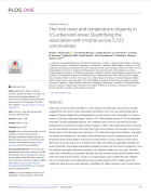
2021 | Terrestrial | Technology | Science | Publications & Reports
The tree cover and temperature disparity in US urbanized areas: Quantifying the association with income across 5,723 communities
Robert I. McDonald, Tanushree Biswas, Cedilla Sachar, Ian Housman, Timothy M. Boucher, Deborah Balk, David Nowak, Erica Spotswood, Charlotte K. Stanley, Stefan Leyk
Urban tree cover provides benefits to human health and well-being, but it is often inequitably distributed. In this study, researchers Google Earth Engine (GEE) and an automated machine learning…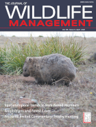
2021 | Terrestrial | Planning | Technology | Science | Publications & Reports
Combining Occurrence and Habitat Suitability Data Improve Conservation Guidance for the Giant Kangaroo Rat
Alyssa E. Semerdjian, H. Scott Butterfield, Robert Stafford, Michael F. Westphal, William T. Bean
This paper in the Journal of Wildlife Management combines nearly 20 years of remote sensing, field/trapping, and modeling data to develop a new approach to the identification and prioritization of…
2021 | Freshwater | Terrestrial | Planning | Technology | Science | Data
Natural Communities Commonly Associated with Groundwater Version 2.0 (NCCAG 2.0)
Kirk Klausmeyer, Jeanette Howard, Melissa Rohde, Charlotte Stanley
The first step to sustainably manage groundwater dependent ecosystems (GDEs) is to identify where they are. The Nature Conservancy developed a statewide spatial database that provides locations of…
2021 | Terrestrial | Technology | Science | Publications & Reports
Tahoe-Central Sierra Initiative Phase 1 Restoration Wood Supply Assessment
Tom Baribault, Daniel Porter, Jessica Burton Desrocher, Douglas Larmour, Mark Rasmussen, Roy Anderson
The Tahoe-Central Sierra Initiative (TCSI) area has seen recent megafires and is highly developed, making the risk new of human-caused wildfire ignitions high. In this report, experts from Mason Bruce…
2021 | Terrestrial | Technology | Science | Publications & Reports
Accelerating Forest Restoration: Stimulating a Forest-Restoration Economy and Rebuilding Resilience in California’s Fire-Adapted Forests
Daniel Porter, Robert Longcor
Forests of the Sierra Nevada and across the western U.S. are under unprecedented threat from catastrophic wildfire, insect outbreaks, and drought. In this briefing paper, which was developed as a…
2020 | Freshwater | Terrestrial | Marine | Planning | Technology | Science | Publications & Reports
Nature-Based Climate Solutions: A Roadmap to Accelerate Action in California
Sydney J. Chamberlin, Michelle Passero, Ashley Conrad-Saydah, Tanushree Biswas, Charlotte K. Stanley
California’s natural and working lands – its forests, grasslands, wetlands, farmlands, rangeland, and urban green spaces – provide Californians with numerous environmental, social,…