Products
We identify issues and uncertainties that pose obstacles to conservation and then—in collaboration with internal and external colleagues—develop science products that help overcome those obstacles.
2026 | Terrestrial | Technology | Science | Publications & Reports
Genomic Data Clarify Identities and Origins of Purported Hybrids and Anomalous Oaks on the Channel Islands of California
Ryan Buck, John Knapp, H. Scott Butterfield, Jeanette Howard, Victoria Sork
Hybridization is common among plant taxa and can lead to adaptive introgression, range expansion, and even island colonization. Patterns of hybridization in natural and disturbed populations can…
2026 | Terrestrial | Planning | Publications & Reports
Exploring Scientific Approaches to Developing Habitat Connectivity Mitigation
Piper Wallingford, Kat Selm, Thomas Biering, Abigail Ramsden
Wildlife crossings are becoming more common, but significant barriers to implementation remain, including high costs, relative novelty, ecological complexity, and opaque regulatory environments.…
2026 | Freshwater | Terrestrial | Planning | Technology | Science | Publications & Reports
The Future of Floodplains: Restoring Nature, Reducing Risk
Aryeh Cohen, Victoria Salgado, J.D. McLandrich, Nicholas Wellbrock, Deborah Glaser, Piper Wallingford, Charlotte Stanley
Across California, climate change is making floods more frequent, intense, and damaging. Powerful atmospheric rivers now deliver enormous volumes of rainfall over short periods, overwhelming rivers,…
2026 | Terrestrial | Technology | Science | Publications & Reports
Comparison of conservation strategies for California Channel Island Oak (Quercus tomentella) using climate suitability predicted from genomic data
Alayna Mead, Sorel Fitz-Gibbon, John Knapp, Victoria L. Sork
Oaks are a foundational species, supporting thousands of other species including California’s Channel Islands. Climate change threatens the persistence of oak species across the Channel Islands,…
2026 | Terrestrial | Technology | Science | Publications & Reports
Landscape genomic analyses of Quercus agrifolia Née predict patterns of adaptedness to future climate and provide guidance for conservation
Ryan C. Buck, H. Scott Butterfield, Elizabeth Hiroyasu, Jeanette Howard, John Knapp, Zachary Principe, Victoria L. Sork
Coast live oaks serve important foundational roles across California oak woodland ecosystems, including across The Nature Conservancy’s grassland and oak woodland preserves. In the most recent…
2026 | Terrestrial | Technology | Science | Publications & Reports
Applying both landscape genomic and ecological niche model predictions to inform conservation strategies of a California foundational oak species
Ryan C. Buck, H. Scott Butterfield, Elizabeth H. T. Hiroyasu, , Jeanette Howard, Zachary Principe, M. Brooke Rose, Victoria L. Sork
Oaks are a foundational species across the globe, supporting the survival of thousands of plant and animal species. In the last drought in California, there was significant oak dieback and, coupled…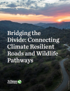
2026 | Terrestrial | Planning | Science | Publications & Reports
Bridging the Divide: Connecting Climate Resilient Roads and Wildlife Pathways
Cara Lacey, Trish Smith, Charlotte Stanley, Deborah Glaser, Piper Wallingford
California stands at a pivotal crossroads where climate resilience, infrastructure modernization, and habitat connectivity must be advanced together. Bridging the Divide offers a roadmap for how…
2026 | Freshwater | Technology | Science | Publications & Reports
Pairing OpenET remotely sensed evapotranspiration with streamflow data to assess the effectiveness of irrigation curtailment for aquatic conservation
J. Eli Asarian, Bronwen Stanford, Nicholas P. Murphy, Michael M. Pollock
Monitoring water conservation can be challenging in locations without adequate metering. Here the authors use satellite-derived estimates of evapotranspiration (ET) to assess watershed-wide responses…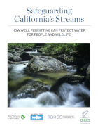
2026 | Freshwater | Science | Publications & Reports
Safeguarding California’s Streams: How Well Permitting Can Protect Water for People and Wildlife
Monty Schmitt (TNC), Nicholas Murphy, Matthew Clifford, Charlie Schneider, Melissa M. Rohde (TNC alum)
Groundwater management is changing across California. In 2018, a legal decision ruled that counties must address the potential negative impacts on public trust resources, particularly streamflow…
2026 | Freshwater | Technology | Science | Publications & Reports
Lagged streamflow depletion due to pumping-induced stream drying: Incorporation into analytical streamflow depletion estimation methods
Sam Zipper, Ian Gambill, Monty Schmitt (TNC), Claire Kouba, Leland Scantlebury, Thomas Harter, Nicholas Murphy
At regional management scales, streamflow depletion due to groundwater pumping cannot be measured directly. Analytical depletion functions (ADFs) are a low-cost, low-complexity modeling approach to…
2026 | Freshwater | Terrestrial | Marine | Science | Publications & Reports
Oren Pollak Memorial Research Fund - 2026 RFP
The Oren Pollak Memorial Research Fund was established in 2000 in memory of Dr. Oren Pollak, a leading grassland ecologist and restoration pioneer, as well as an ardent champion and mentor for…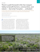
2025 | Freshwater | Terrestrial | Science | Publications & Reports
There’s a path forward in the San Joaquin Valley to benefit farmers, communities, and nature — but only if we plan . . . and plant
H. Scott Butterfield (TNC), Jeanette K. Howard (TNC), Daniel Toews (TNC), Abigail Hart (TNC), Kathy Wood-McLaughlin
To meet the goals of California's 2014 Sustainable Groundwater Management Act (SGMA), more than 500,000 acres of irrigated agricultural land will need to be retired. TNC and partners…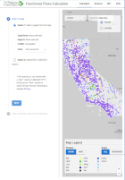
2025 | Freshwater | Planning | Technology | Microsite
Functional Flows Calculator
Kirk Klausmeyer, Bronwen Stanford, Nathan Enerson, Steven Sonvisen, Falk Schuetzenmeister, and Jam Hamidi
To protect water for nature, we first need to understand current flow conditions in our rivers, and how that flow is altered from natural conditions. Under the California Environmental Flows Framework…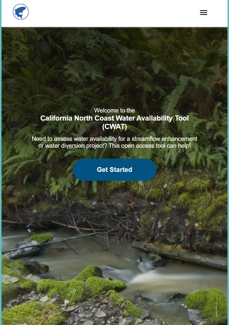
2025 | Freshwater | Planning | Technology | Microsite
California North Coast Water Availability Tool
Jennifer Carah, Ben Kerr, Mia van Docto, Anders Farr, Kirk Klausmeyer, Steven Sonvisen, Siena Testa, and Jam Hamidi
Water is essential for California’s people, economy, and environment, yet water availability for people and nature is not well understood. This tool efficiently assesses water availability in…
2025 | Terrestrial | Technology | Publications & Reports
Real-time island biosecurity surveillance: evaluating a wireless camera network for AI-assisted early detection of invasive mammals on Santa Cruz Island, CA
Lara J. Brenner, Nathaniel Rindlaub, Juliana Matos, Scott Meyler, Sue Pollock, Falk Schuetzenmeister, Nick D. Holmes
Invasive mammals like rats pose a major threat to island ecosystems and endemic species. This study tests a wireless camera network on Santa Cruz Island that uses AI to detect nonnative mammals in…
2025 | Terrestrial | Technology | Science | Publications & Reports
Phylosymbiosis and Elevated Cancer Risk in Genetically Depauperate Channel Island Foxes
Alexandra L. DeCandia, Jasmine Lu, Emily E. Hamblen, Lara J. Brenner, Julie L. King, Calypso N. Gagorik, Juliann T. Schamel, Stacy S. Baker, Francesca J. Ferrara, Melissa Booker, Andrew Bridges, Cesar Carrasco, Bridgett M. vonHoldt, Klaus-Peter Koepfli, Jesús E. Maldonado
Isolated island species may be more susceptible to disease because of their lack of genetic diversity. Santa Catalina Island foxes have the highest rate of cancer ever measured in wildlife - over 50%…
2025 | Terrestrial | Planning | Science | Publications & Reports
The wildlife attitude-acceptability framework’s potential to inform human dimensions of wildlife science and practice
Alexander L. Metcalf, Elizabeth Covelli Metcalf, Lara J. Brenner, Holly K. Nesbitt, Conor N. Phelan, Michael S. Lewis, Justin A. Gude
The long-term survival of large carnivores like wolves, grizzly bears and mountain lions depends not just on ecological factors like habitat, but also on social factors like human acceptance of their…
2025 | Terrestrial | Planning | Publications & Reports
Conservation planning for climate change vulnerability across the islands of the Californias
Lara J. Brenner, Piper D. Wallingford, Nick D. Holmes, John J. Knapp, John M. Randall, Scott A. Morrison
Island ecosystems are especially vulnerable to climate change, yet planning for these impacts remains challenging due to a lack of available data. This paper reports on a collaborative workshop across…
2025 | Terrestrial | Technology | Science | Publications & Reports
The gut microbiomes of Channel Island foxes and island spotted skunks exhibit fine-scale differentiation across host species and island populations
Samantha Pasciullo Boychuck, Lara J. Brenner, Calypso N. Gagorik, Juliann T. Schamel, Stacy Baker, Elton Tran, Bridgett M. vonHoldt, Klaus-Peter Koepfli, Jesús E. Maldonado, Alexandra L. DeCandia
On California’s Channel Islands, two rare carnivores—the island fox and island spotted skunk—have coexisted for millennia despite competing for similar resources. This study explores…
2025 | Terrestrial | Technology | Science | Publications & Reports
Evaluating UAV LiDAR and Field Spectroscopy for Estimating Residual Dry Matter Across Conservation Grazing Lands
Bruce Markman, H. Scott Butterfield, Janet Franklin, Lloyd Coulter, Moses Katkowski, and Dan Sousa
Residual dry matter has been widely used to monitor grazing impacts across conservation grazing lands for more than 75 years, largely done with time-intensive, expensive, and hard-to-reproduce…