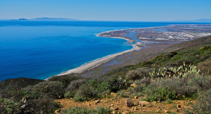
With California’s population on track to reach 50 million people, the demand for energy, water, and land will continue to grow. Climate change will compound the strains on society and the environment. Most of this population growth will be centered in larger cities that are already struggling to maintain aging transportation and water infrastructure.
But nature can play an important role in the redevelopment of these systems. Wetlands treat storm water, oyster reefs buffer storm surges, and shade trees reduce heat, providing the benefits of traditional infrastructure while adding scenery and wildlife habitat.
Conservancy scientists are demonstrating how society can minimize trade-offs between development and conservation through innovative regional planning. And by showing what nature can do for cities–and what cities can do for nature–we can develop models for improving the quality of urban life, with broad application on an urbanizing planet.
Science in Action

Terrestrial | Marine | Science
TNC and FEMA
How do we increase climate resilience in ways that work for people and nature?
Terrestrial | Marine | Planning
TNC and the U.S. Navy
How can we protect natural resource and coastal military assets from sea level rise?
2018 | Terrestrial | Planning | Science | Publications & Reports
Impact of solar and wind development on conservation values in the Mojave Desert
Sophie S. Parker, Brian S. Cohen, James Moore
This paper discusses changes in the conservation value of lands in the California Mojave Desert caused by renewable energy development that occurred between 2009 and 2016. The authors remotely assess…
2018 | Freshwater | Terrestrial | Marine | Planning | Science | Publications & Reports
Conserving California's Coastal Habitats: A Legacy and a Future with Sea Level Rise
Walter N. Heady, Brian S. Cohen, Mary G. Gleason, Joshua N. Morris, Sarah G. Newkirk, Kirk R. Klausmeyer, Hilary R. Walecka, Elizabeth Gagneron
Sea level rise presents a new challenge to coastal conservation. The authors quantified and mapped the vulnerability of habitats, imperiled species, and conservation lands to sea level rise throughout…
2018 | Freshwater | Terrestrial | Planning | Science | Publications & Reports
Water Supply and Habitat Resiliency for a Future Los Angeles River: Site-Specific Natural Enhancement Opportunities Informed by River Flow and Watershed-Wide Action
Brian Cohen, Shona Ganguly, Sophie Parker, John Randall, Jill Sourial, and Lara Weatherly of The Nature Conservancy, Land IQ, Natural History Museum Los Angeles County, WRC Consulting Services Inc., Travis Longcore, University of Southern California, Connective Issue, Inc.
As a basic principle of ecological systems, a watershed’s hydrology determines the flow characteristics of its river system. These flows define what the biological characteristics of that…
2018 | Freshwater | Terrestrial | Planning | Science | Publications & Reports
Ecological spillover dynamics of organisms from urban to natural landscapes
Jill E. Spear, Erik K. Grijalva, Julia S. Michaels, Sophie S. Parker
This paper discusses the impact of urban-dwelling plants and animals on regional wildland populations, both within and across species. The authors reviewed the global conservation literature and…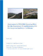
2018 | Terrestrial | Planning | Science | Publications & Reports
Assessment of Wildlife Crossing Sites for the Interstate 15 and Highway 101 Freeways in Southern California
Seth P. D. Riley, Trish Smith, T. Winston Vickers
Freeways are barriers to wildlife passage and gene exchange. In Southern California, mountain lion movement has been severely restricted due to this infrastructure. As a result, the mountain…2017 | Freshwater | Terrestrial | Planning | Publications & Reports
Rethinking the Grid: Optimizing California’s Transmission System For Renewable Energy
Energy+Environmental Economics for The Nature Conservancy, Arne Olson, Doug Allen, Vivian Li, Emily Leslie
California leads the nation in the transition to a clean energy economy. However, current transmission planning processes limit development of new renewable resources. This report (slide deck),…
2017 | Terrestrial | Planning | Microsite
The Bay Area Greenprint
Carrie Schloss, Elizabeth O'Donoghue, Christa Cassidy, Tom Robinson, Serena Unger, Adam Garcia, Dan Rademacher
The Bay Area Greenprint tool provides land use and infrastructure agencies, consultants, and advocates easily accessible, interpretable, and scientifically robust information on habitat and ecosystem…
2017 | Terrestrial | Planning | Publications & Reports
Solar Energy Development and Regional Conservation Planning
D.R. Cameron, L. Crane, S.S. Parker, J.M. Randall
This book chapter discusses how California's greenhouse gas emission reduction goals spurred solar development in the Mojave Desert—development that could have negative impacts if poorly…
2016 | Terrestrial | Publications & Reports
Prioritizing Riparian Conservation: A Methodology Developed for the Santa Clara River, California
Sophie S. Parker, Lily N. Verdone, E.J. Remson, Brian S. Cohen
This study addresses a basic problem shared by many riparian conservation projects: parcelization. Having dozens or hundreds of owners along a river can make conserving riparian ecosystems a difficult…
2015 | Terrestrial | Planning | Publications & Reports
Conservation Planning for Offsetting the Impacts of Development: A Case Study of Biodiversity and Renewable Energy in the Mojave Desert
Jason Kreitler, Carrie A. Schloss, Oliver Soong, Lee Hannah, Frank W. Davis
In the past, mitigation to address impacts from development have lacked a regional planning perspective resulting in efficient design across a set of sites for a suite of impacts. This paper…
2015 | Terrestrial | Science | Publications & Reports
Survival and mortality of pumas (Puma concolor) in a fragmented, urbanizing landscape
Vickers, T.W., J. N. Sanchez, C. Johnson, S.A. Morrison, R. Botta, T. Smith, B.S. Cohen, P. Huber, W.M. Boyce
Conservation of wide-ranging species like mountain lions is especially difficult in highly fragmented landscapes, such as coastal southern California. Research into their populations can provide…
2015 | Terrestrial | Planning | Science | Publications & Reports
Integrating Land Conservation and Renewable Energy Goals in California: A Study of Costs and Impacts Using the Optimal Renewable Energy Build-Out (ORB) Model
The Nature Conservancy: Erica Brand, Laura Crane, Dick Cameron, Energy and Environmental Economics: Grace C. Wu, Nick Schlag
Integrating ecological data into long-term energy planning is critical to meet both California’s long term energy and conservation goals. This report assesses the potential trade-offs associated…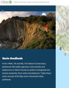
2015 | Terrestrial | Maps & Webmaps
Conservation Legacy in Marin County, California
Katie Andrews, Megan Webb, Robin Cox
This interactive webmap takes a multimedia approach to showcase the Conservancy’s conservation legacy in Marin County, California. Eleven achievements are profiled with photographs and…
2014 | Terrestrial | Planning | Publications & Reports
Modeling residential development in California from 2000 to 2050: Integrating wildfire risk, wildland and agricultural encroachment
M.L. Mann, P. Berck, M.A. Moritz, E. Batllori, J.G. Baldwin, C.K. Gately, D.R. Cameron
Between 1940 and 2000, nearly 10 million housing units were constructed in California. This new development led to increased interaction between human and natural communities. Tha authors of this…
2014 | Terrestrial | Publications & Reports
Incorporating critical elements of city distinctiveness into urban biodiversity conservation
Strategies for preserving the Earth’s biodiversity that can be employed within cities are likely to become more common as urban areas continue to increase in size and number. Progress towards…
2014 | Terrestrial | Science | Publications & Reports
Fractured genetic connectivity threatens a southern California puma (Puma concolor) population
H.B. Ernest, T.W. Vickers, S.A. Morrison, M.R. Buchalski, W.M. Boyce
Highly fragmented landscapes can pose myriad threats to wide-ranging species like mountain lions. Coastal southern California has long been the focus of research into demographics, genetics, and…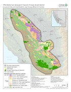
2013 | Terrestrial | Planning | Data
Western San Joaquin Valley Least Conflict Solar Energy Assessment data
Butterfield, H.S., D. Cameron, E. Brand, M. Webb, E. Forsburg, M. Kramer, E. O’Donoghue, L. Crane
The Western San Joaquin Valley Least Conflict Solar Energy Assessment characterizes the land use constraints and opportunities associated with siting solar energy facilities in the Western San Joaquin…
2013 | Terrestrial | Planning | Publications & Reports
Western San Joaquin Valley Least Conflict Solar Energy Assessment
Butterfield, H.S., D. Cameron, E. Brand, M. Webb, E. Forsburg, M. Kramer, E. O’Donoghue, L. Crane
A Conservancy analysis of the western Mojave Desert identified where human activities had degraded the conservation value of lands making them potentially low impact locations for development of solar…