Products
We identify issues and uncertainties that pose obstacles to conservation and then—in collaboration with internal and external colleagues—develop science products that help overcome those obstacles.
2020 | Freshwater | Terrestrial | Technology | Science | Publications & Reports
Conservation of Mojave Desert springs and associated biota: status, threats, and policy opportunities
Sophie S. Parker, Andy Zdon, William T. Christian, Brian S. Cohen, Maura Palacios Mejia, Naomi S. Fraga, Emily E. Curd, Kiumars Edalati, Mark A. Renshaw
This paper presents results from the Mojave Desert Springs research project, and discusses why the conservation of these groundwater-dependent ecosystems is so critical to biodiversity. The authors…
2020 | Freshwater | Terrestrial | Technology | Science | Publications & Reports
The utility of environmental DNA from sediment and water samples for recovery of observed plant and animal species from four Mojave Desert springs
Maura Palacios Mejia, Emily Curd, Kiumars Edalati, Mark A. Renshaw, Roy Dunn, Daniel Potter, Naomi Fraga, Jenna Moore, Justin Saiz, Robert Wayne, Sophie S. Parker
This paper presents results from the Mojave Desert Springs research project. The authors used an environmental DNA (eDNA) technique to assess biodiversity at four naturally occurring springs. They…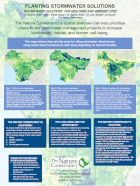
2020 | Freshwater | Terrestrial | Technology | Science | Maps & Webmaps
Planting Stormwater Solutions
Brian Cohen, Kelsey Jessup, Sophie Parker, John Randall, Jill Sourial
Cities across Southern California are investing in new infrastructure to address the challenges of stormwater management. We promote the use of nature-based solutions to ensure projects both treat…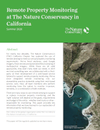
2020 | Terrestrial | Technology | Publications & Reports
Remote Property Monitoring at The Nature Conservancy in California
Ethan Inlander, Katie Andrews, Contributors: Jennifer Chin, Sue Pollock, Mike McFadden, Scott Hardage, Scott Butterfield, Tod Rubin
With this publication, TNC in California marks a major shift in its approach to conservation easement monitoring. At the crossroads of conservation, stewardship and technology lies remote property…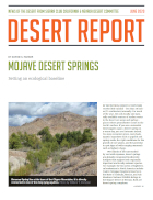
2020 | Freshwater | Terrestrial | Technology | Science | Publications & Reports
Mojave Desert Springs: setting an ecological baseline
This article appears in the Desert Report, a news publication of the Sierra Club California/Nevada Desert Committee. The article introduces the Mojave Springs Research Project, led by The Nature…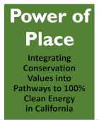
2020 | Terrestrial | Technology | Science | Data
Low-impact land use pathways to deep decarbonization of electricity
Grace C. Wu, Emily Leslie, Douglas Allen, Oluwafemi Sawyerr, D. Richard Cameron, Erica Brand, Brian Cohen, Marcela Ochoa, Arne Olson
California has ambitious climate and energy policies that call for the development of significant amounts of new zero-carbon energy by midcentury. The Power of Place study looks at multiple pathways…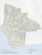
2020 | Terrestrial | Planning | Technology | Science | Publications & Reports
Jack and Laura Dangermond Preserve Rangeland Management Plan
Butterfield, H.S., M. Katkowski, J. Cota, O. Sage, C. Sage, K. Easterday, D. Zeleke, L. Riege, S. Gennet, K. Lin, B. Leahy, M. Bell, M. Reynolds
Cattle grazing is the dominant land management tool TNC has to manage biodiversity and reduce the threat of catastrophic wildfire at the TNC's Jack and Laura Dangermond Preserve. This…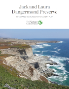
2020 | Freshwater | Terrestrial | Marine | Planning | Technology | Science | Publications & Reports
Jack and Laura Dangermond Preserve Integrated Resources Management Plan
Butterfield, H.S., M. Reynolds , M.G. Gleason, M. Merrifield, B.S. Cohen, W.N. Heady, D. Cameron, T. Rick, E. Inlander, M. Katkowski, L. Riege, J. Knapp, S. Gennet, G. Gorga, K. Lin, K. Easterday, B. Leahy, M. Bell
This Plan frames the biological and cultural significance and provides the short- and long-term goals, objectives, and priority actions for the Jack and Laura Dangermond Preserve.
2020 | Terrestrial | Technology | Science | Publications & Reports
Shrub and vegetation cover predict resource selection use by an endangered species of desert lizard
Christopher J. Lortie, Jenna Braun, Michael Westphal, Taylor Noble, Mario Zuliani, Emmeleia Nix, Nargol Ghazian, Malory Owen, H. Scott Butterfield
This paper evaluates how endangered species with highly restricted habitat needs and increasingly small population sizes (using blunt-nosed leopard lizard as our example), select and use available…
2020 | Freshwater | Terrestrial | Marine | Technology | Publications & Reports
Technology Catalyst Fund - 2019 Annual Report
Conservation needs to harness technology to meet the complex challenges of today’s world. The Technology Catalyst Fund provides early stage resources to investigate and prototype technologies…
2019 | Terrestrial | Technology | Science | Publications & Reports
Parched pines: a quantitative comparison of two multi-year droughts and associated mass mortalities of bishop pine (Pinus muricata) on Santa Cruz Island, California
Annalise Taylor, Tanushree Biswas, John M. Randall, Kirk Klausmeyer, Brian Cohen
In Western North America, droughts are expected to increase in frequency and intensity as the region’s climate changes. Over past decades, land managers on Santa Cruz Island, California…
2019 | Freshwater | Marine | Planning | Technology | Science | Publications & Reports
Insights into estuary habitat loss in the western United States using a new method for mapping maximum extent of tidal wetlands
Laura S. Brophy, Correigh M. Greene, Van C. Hare, Brett Holycross, Andy Lanier, Walter N. Heady, Kevin O’Connor, Hiroo Imaki, Tanya Haddad, Randy Dana
The authors of this study generated new maps of current and historical tidal wetlands in 450 estuaries throughout Washington, Oregon, and California. Using laser-mapping technology known as LIDAR…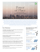
2019 | Terrestrial | Planning | Technology | Science | Publications & Reports
Power of Place: Summary of Policy Recommendations
Summary available in English and Spanish.
2019 | Freshwater | Terrestrial | Planning | Technology | Science | Publications & Reports
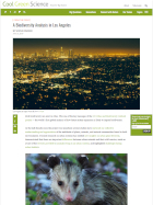
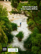
Biodiversity Analysis in Los Angeles (BAILA) Report
Parker SS, Randall JM, Pauly GB, Li E, Brown BV, Cohen BS
This report is a product of the Biodiversity Analysis in Los Angeles (BAILA) project. It provides details on why we conducted our analysis, how the partnership between the Museum and the Conservancy…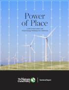
2019 | Terrestrial | Planning | Technology | Science | Publications & Reports
Power of Place: Land Conservation and Clean Energy Pathways for California
Grace C. Wu, Emily Leslie, Douglas Allen, Oluwafemi Sawyerr, D. Richard Cameron, Erica Brand, Brian Cohen, Marcela Ochoa, Arne Olson
California has ambitious climate and energy policies that call for the development of significant amounts of new zero-carbon energy by midcentury. The Power of Place study looks at multiple pathways…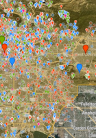
2019 | Freshwater | Terrestrial | Planning | Technology | Science | Data
Biodiversity Analysis in Los Angeles (BAILA) data
Enjie Li, Sophie S. Parker, Gregory B. Pauly, John M. Randall, Brian V. Brown, Brian S. Cohen
This dataset is a product of the Biodiversity Analysis in Los Angeles (BAILA) project, and demonstrates a new way to evaluate urban biogeography—patterns in the distribution of species across…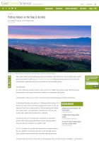
2019 | Terrestrial | Planning | Technology | Science | Blogs
Putting Nature on the Map (Literally)
Carrie Schloss, Liz O'Donoghue
2019 | Freshwater | Terrestrial | Planning | Technology | Science | Publications & Reports
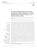
An urban biodiversity assessment framework that combines an urban habitat classification scheme and citizen science data
Enjie Li, Sophie S. Parker, Gregory B. Pauly, John M. Randall, Brian V. Brown, Brian S. Cohen
This paper presents a new way to evaluate urban biogeography—patterns in the distribution of species across urban areas. The authors developed a hierarchical, quantitative method for classifying…
2019 | Marine | Technology | Science | Publications & Reports
eCatch: Enabling collaborative fisheries management with technology
Matt Merrifield, Mary Gleason, Lyall Bellquist, Kate Kauer, Dwayne Oberhoff, Chad Burt, Steve Reinecke, Michael Bella
In 2006, The Nature Conservancy of California purchased 13 federal groundfish permits in California with the objective of managing the fishing and reporting activities in a manner that protected…