Can California protect its iconic coastline as sea levels rise?
In the face of climate change and rising sea levels, the California coast we know today will not be the coastline of the future.
Including estuaries like San Francisco Bay, California’s coastline measures over 3,400 miles (5,472km) and encompasses a range of physical settings that support a great diversity of habitats, some of which are found nowhere else in the world. California’s beaches, tide pools, wetlands, estuaries, and coastal uplands also provide important services to people in the form of storm buffering, water filtration, fisheries production, and recreation – all of which fuel the state’s economy.
As waters rise and coastal margins erode, investments that have been made in coastal conservation to protect important habitats and species are at risk. How the State anticipates and adapts to changes from sea level rise will determine what the future coastline will look like, how well conserved and protected its coastal ecosystems will be, and what benefits the coast will offer future generations. To make informed decisions, we need to understand where coastal ecosystems are vulnerable to sea level rise, and where there are opportunities to conserve the coastline of the future.
To provide answers to these questions, Conservancy scientists are working in partnership with the California Coastal Conservancy to quantify the vulnerability of coastal habitats to sea level rise, and map and quantify where there are opportunities to conserve or enhance coastal habitats into the future. Our study area spans the entire California coast and extends inland 8 km beyond the projected footprint of 1.5 meters of sea level rise. Using best available spatial data, we characterized the landscape into 35 wetland and upland habitat types and 17 developed or agricultural land uses. We spatially quantified the vulnerability of coastal habitats as the relationship between the potential impact from sea level rise exposure and the habitat’s adaptive capacity or ability to transgress inland over time in response to sea level rise. We also identified the biggest impediments to adaptive capacity, the anticipated “loss” given no action, and where the best opportunities are to enhance and maintain habitat area and mitigate habitat losses.
This state-of-the-science assessment can be used to guide conservation strategies such as land conservation, management in place for resilience, and the reclamation of habitat from the built environment. By making the analyses standardized and modular, the assessment is scalable to other geographies and may be updated as data are improved, such as when new sea level rise projections, become available.
California’s iconic coast provides not only invaluable habitat for native species – but also incalculable benefits for people. Science can help ensure those values persist, even in a rapidly changing world.
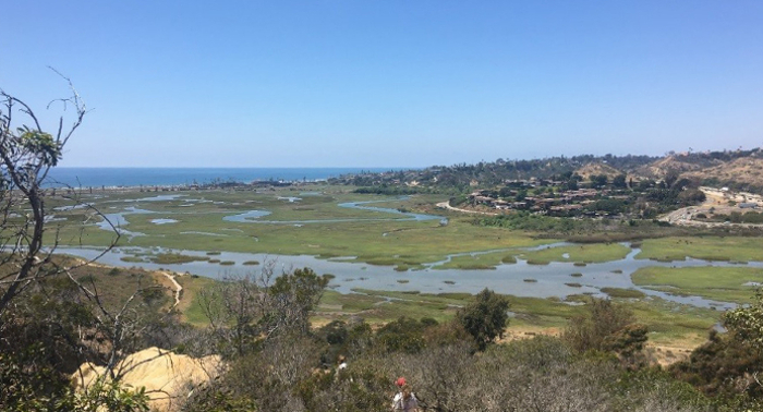
One way estuarine marshes could adapt to rising sea levels is by collecting sediments – and migrating vertically. Unfortunately, the sediments estuarine marshes need are often locked behind human-made structures, therefore, marshes will need to adapt by slowly moving inland in response to rising sea levels. However, the built environment may preclude that natural inland transgression. © Walter Heady/TNC
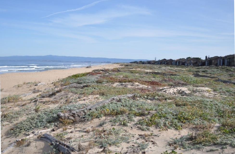
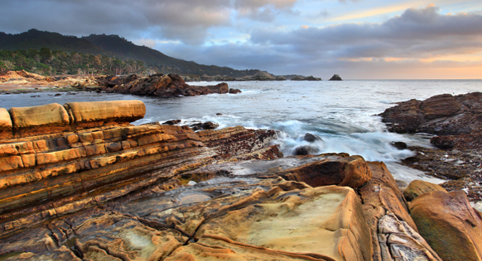
Beaches will move upwards and inland in response to sea level rise. Dunes along beaches provide sand to “feed” and maintain beaches, helping them move vertically in response to sea level rise, as well as providing space for beaches to move inland in to. Photo: © Walter Heady/TNC
Laura S. Brophy, Correigh M. Greene, Van C. Hare, Brett Holycross, Andy Lanier, Walter N. Heady, Kevin O’Connor, Hiroo Imaki, Tanya Haddad, Randy Dana
The authors of this study generated new maps of current and historical tidal wetlands in 450 estuaries throughout Washington, Oregon, and California. Using laser-mapping technology known as LIDAR…
Walter N. Heady, Brian S. Cohen, Mary G. Gleason, Joshua N. Morris, Sarah G. Newkirk, Kirk R. Klausmeyer, Hilary R. Walecka, Elizabeth Gagneron
Sea level rise presents a new challenge to coastal conservation. The authors quantified and mapped the vulnerability of habitats, imperiled species, and conservation lands to sea level rise throughout…
Szeptycki, L., E. Hartge, N. Ajami, A. Erickson, W. N. Heady, L. LaFeir, B. Meister, L. Verdone, J.R. Koseff
The drought in California rekindled interest in ocean desalination as a new and reliable water supply option; yet desalination is expensive, energy intensive, potentially emits greenhouse gases,…
Walter N. Heady, Kevin O'Connor, Jennifer Kassakian , Kate Doiron, Charles Endris, Daniel Hudgens, Ross P. Clark , Jena Carter , Mary G. Gleason
Estuaries are some of the most productive ecosystems on the planet. This inventory classifies more than 600 coastal confluences on the West Coast of the United States. Each estuary was classified…
Brent B. Hughes, Matthew D. Levey, Jennifer A. Brown, Monique C. Fountain, Aaron B. Carlisle, Steven Y. Litvin, Correigh M. Greene, Walter N. Heady, Mary G. Gleason
Estuaries support significant biodiversity and important ecosystem functions such as providing rearing habitat for juvenile fish and invertebrates. This report synthesizes the scientific…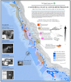
Mary Gleason, Sarah Newkirk, Matt Merrifield, Jeanette Howard, Robin Cox, Megan Webb, Jennifer Koepcke, Brian Stranko, Bethany Taylor, Mike Beck, Roger Fuller, Dick VanderSchaaf, Jena Carter
While significant progress has been made over the past few decades in improving estuarine water quality, restoring wetland habitats, and incorporating estuarine habitats into managed areas, estuarine…